Investigations into the history of the parish
The Eardisland History & Heritage Group (EHHG) began by undertaking oral history research in 1993, obtaining information from those who had been living in the parish during the 20th century. There were 60 audio tapes made and subsequently used as the basis of the book published in 1995: ‘Eardisland: an oral history’. These tapes will be digitised to make them widely available. The group produced two other major publications: ‘Eardisland: Portrait of a Village’ (a photographic history) and ‘A Case Study of Burton Court’ (providing details of the excavations undertaken there and the implication of the research for the wider history of the parish.) In addition, three DVD films were produced giving insights into the social history of Eardisland. Copies of all of these items are still available. In the year 2000 a broader history group was established since the work of the oral history group was largely completed.
Archaeological Group
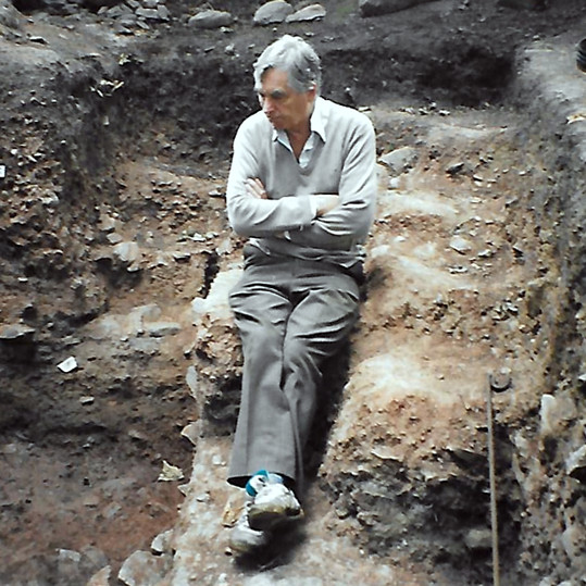
The Archaeological Project Group was formed in 2000 which in turn undertook projects initially suggested by Dr Ray and Tim Hoverd of Hereford County Archaeology service. The Archaeological Projects Group was formed following the discovery by two 7-year-old twins, of two pieces of pottery in an abandoned badger set in the grounds of Burton Court. These were examined by the archaeologists from Hereford and found to be of early Norman period. The excavation lasted ten years and major finds, confirmed by experts, were more than 2000 pieces of the Norman pottery, some Roman ware, spindle whorls, many unusual bone items, together with a rare Norman gaming counter. These artefacts were important indicators of the social and economic position of Burton Court from 1066 to the 12th century, being the latest date attributed to the pottery. The discovery of a Bronze Age dirk nearby, took the history of the area back 3000 years.
Other excavations duly took place in various areas of the parish and finds were made from the Iron Age, Bronze Age, and Roman period. In-house reports were produced for each archaeological project. The finds made during the excavations have now been recorded by the local officer i/c the Portable Antiquities Scheme (Peter Reavill with the assistance of a group member, Pat Kay) and can be seen online. These provide details (often with photographs) of each one identified and recorded by a specialist or expert. The dirk is on display in the museum in Hereford.
Research projects
The archaeological work of the group gradually came to an end as a result of the demands of large-scale excavations which were beyond the capabilities of our small, aging group. However, this resulted in the group morphing into a research and discussion team. Investigations were undertaken into the history of the parish using documentary and historical sources, maps, photographs, and other recorded data under the direction of the late George Alderson. Many in-house Papers were written when research into specific aspects of the parish were completed and which can be read on the Parish Website.
A project begun, but interrupted by the demands of the Covid pandemic, is that of an analysis of the field names in the parish, their size, usage and significance. The Tithe Map of 1842 provides the information on which the research is based together with earlier sources located by George Alderson. These provide evidence from which he ascertained the earliest names of the fields, (some dating back to 13th. century), their place in the landscape and for which we could note the archaeological record associated with them.
The research aims for this project were based on several factors. Our group (largely thanks to George) has a detailed overview of key areas of interest and significance from a historical perspective. We know the Manor and Township boundaries and the names of all fields of interest as recorded on the Tithe Map. We also know the names of many fields preceding those so marked, based on George’s careful research. We know where archaeological and other historical finds have been made and we know much about the topography of the parish and have examined detailed maps showing this. As a result, a great deal of information has been gathered in recent years, but inevitably, research has been curtailed by the demands the pandemic. We remain interested in examining any estate or other maps which give further information about the field systems in the parish, should they come to light.
Most of the in-house papers produced by the group, were under the direction of George, who gave the team direction. He favoured a strict rule that nothing should be ‘published’ unless well referenced to documentary evidence. On this basis among the topics examined have been the Townships of Burton and Hardwick, the Church and various significant properties; the toll roads and the mills of Eardisland. Maps have been drawn to show the contours; the hundred boundaries; the detached part of the parish; the waterways; old roadways, tracks and lanes. The Tithe map of 1842 has been examined carefully to see how the known archaeological information relates to particular areas. This provides a view of the significant areas of the parish over time. Work was underway to assess the changes in field boundaries and field shapes and changing land ownership patterns when the pandemic brought such study to a close.
It is hoped that when the rules regarding social contact are lifted and meetings can again be held that we will be in a position to organise an exhibition of aspects of the projects undertaken by the group. Such a display would include extracts from the oral history tapes, some of the photographic collection and maps and documents held. Also, some of the important finds made by our group together with some from Hugh Lowe’s assemblage, which he has collected over many years on his land. Such material will be selected from the items that can now be seen on the links provided by Peter Reavill. They will be displayed in the Dovecote Exhibition room, above the village shop. The on-line links to archaeological finds made in the parish are now available on this Parish Website.
The significance of Tithe Maps
Tithe Maps date from the 1840s and follow old parish boundaries. They include those of fields, woods, roads and rivers. All field names are recorded, and some of the more usual can give rise to interesting research programmes. For example, in Eardisland, we have several fields with the name ‘bury’ (Bodbury fields in Lower Burton). The geographical use of “-bury” and “Bury” is derived from burg or burh, Old English for a town or fortified place. Throughout Herefordshire there are many Iron Age earthworks known by an Anglo-Saxon name ending in 'bury'. Examples include Oldbury Camp in Much Marcle (SO 632 326); Kilbury Camp Ledbury (SO 72 38); and Ivingtonbury hill fort near Leominster. The fields in Eardisland with this designation may therefore give rise to the possibility that in Anglo Saxon times (5th- 11th century) they were places of defence and therefore suggest areas of further archaeological investigation.
Tithe Maps are useful for family history studies since they are usually large scale and can show important information about the sites of old buildings which may have subsequently disappeared, and where the common fields, woods, and meadows were. It is possible to search for unusual features and for lost buildings such as mills, quarries and cottages. The landowners’ names are also useful in gaining an insight into changing ownership. The maps are usually held in the county archives (as are those for Eardisland.)
Tithes were taxes paid to the local church, both in cash and ‘in kind’ (such as produce of the land). People paid one tenth of everything they produced. In 1836 the Tithe Redemption Act converted all ‘in kind’ payments into monetary values.
Each map is split into apportionments, a record of how the land was divided up at the time the map was drawn. The apportionment gives information for every tithable piece on the map regarding the name of owner and occupier, the field name, the type of cultivation, the acreage, and its tithe valuation. Every plot on the tithe map has a number which matches the entry in the apportionment.
By the end of 19th century with changing farming methods and land values the concept of the tithe was no longer a viable method of operation. They discouraged farming improvements because if production went up, so did tithe payments to the church and sometimes to the landowner. In 1936, tithes were abolished.
Three copies of the tithe map for Eardisland were produced in 1842, one for the Tithe Commissioners, a copy for the parish and a third for the Diocesan Registry. The maps are beautiful to look at having been drawn carefully and one copy coloured to indicate inhabited properties, other buildings, rivers and brooks. Each was of very large size. Consequently, they become items for map collectors when they become available for any reason. Two of the Eardisland maps are in the Hereford Archive Records Centre (HARC) and can be viewed and photographed. However, the third copy (that provided for the Parish records), is missing. In the course of examining church documents George Alderson discovered a note in the church files for October 1927 which indicated that the map was held by a firm of solicitors in Leominster. Unfortunately, they have subsequently lost track of its whereabouts. This custody receipt remains in the files recorded by George.
One of the major projects which the EH&HG has been undertaking is a more careful analysis of the Tithe Map. The work of George Alderson was invaluable in locating earlier maps and documents with field names noted since they gave information about how they were named in much earlier times (some references were from 13th and 14th centuries). The matter of whether field names change substantially or remain much the same over such time periods gives rise to all kinds of further investigation. It is hoped to progress with this analysis begun by George in the future when discussions can resume. Meanwhile, the search continues for the lost tithe map of Eardisland.